GPS Based Android Application
GPS Tracking
A GPS tracking unit is a device that uses the Global Positioning System to determine the precise location of a vehicle, person, or other asset to which it is attached and to record the position of the asset at regular intervals. The recorded location data can be stored within the tracking unit, or it may be transmitted to a central location data base, or internet-connected computer, using a Cellular (GPRS), Radio, or Satellite modem embedded in the unit. This allows the asset's location to be displayed against a map backdrop either in real-time or when analyzing the track later, using customized software.
Software Features
- You can easily track your person or object world wide.
- Our application can provide street level map to see your object so that you can get detail data.
- This software is useful to any type of organization or company they want to monitor movable object.
Manager Features
![]() View real-time location
View real-time location
![]() Tracking & Monitoring - Real Time
Tracking & Monitoring - Real Time
![]() Tracking & Monitoring - History
Tracking & Monitoring - History
![]() Stop Violation
Stop Violation
![]() Route Violation
Route Violation
![]() Driving time zone Violation
Driving time zone Violation
![]() Two Way communication
Two Way communication
![]() Mapping Features
Mapping Features
![]() Upload offline Data(e.g. Analog Data)
Upload offline Data(e.g. Analog Data)
![]() Fleet Maintenance
Fleet Maintenance
![]() Offline Alerts - Speed Violation
Offline Alerts - Speed Violation
![]() Optimum Utilization of vehicles
Optimum Utilization of vehicles
![]() Send SMS/E-mail for reports
Send SMS/E-mail for reports
![]() View tracker status (e.g. A.C. ON/OFF)
View tracker status (e.g. A.C. ON/OFF)
![]() Switch off vehicle engine (for specific tracker models only)
Switch off vehicle engine (for specific tracker models only)
![]() Replay a trip (PlayBack)
Replay a trip (PlayBack)
![]() Define areas and landmarks on the maps
Define areas and landmarks on the maps
![]() Geofence, speed, emergency and other customized alerts
Geofence, speed, emergency and other customized alerts
![]() Generate reports using filter conditions (e.g. speed, date, time)
Generate reports using filter conditions (e.g. speed, date, time)
![]() Trip reports (e.g. engine on time, fuel consumption, average speed, idle time)
Trip reports (e.g. engine on time, fuel consumption, average speed, idle time)
![]() Export tracking data to spreadsheets (Download KML)
Export tracking data to spreadsheets (Download KML)
User Features
![]() Tracking & Monitoring - Real Time
Tracking & Monitoring - Real Time
![]() Tracking & Monitoring - History
Tracking & Monitoring - History
![]() Mapping Features
Mapping Features
![]() Observe Journey
Observe Journey
![]() Reports (Allocated by Manager)
Reports (Allocated by Manager)
![]() Alerts (Allocated by Manager)
Alerts (Allocated by Manager)
Admin Features
![]() Manager Management
Manager Management
![]() Report Allocation
Report Allocation
![]() Parameter Allocation
Parameter Allocation
![]() Upload Analog Data
Upload Analog Data
![]() Add New Device
Add New Device
![]() Tracking & Monitoring - Real Time
Tracking & Monitoring - Real Time
![]() Tracking & Monitoring - History
Tracking & Monitoring - History
![]() Two Way communication
Two Way communication
![]() Mapping Features
Mapping Features
![]() Temperature Monitoring
Temperature Monitoring
![]() Fleet Maintenance
Fleet Maintenance
![]() Offline Alerts - Speed Violation
Offline Alerts - Speed Violation
![]() Optimum Utilization of vehicles
Optimum Utilization of vehicles
![]() Send SMS/GPRS commands to GPS trackers
Send SMS/GPRS commands to GPS trackers
![]() View tracker status (e.g. A.C. ON/OFF)
View tracker status (e.g. A.C. ON/OFF)
![]() Switch off vehicle engine (for specific tracker models only)
Switch off vehicle engine (for specific tracker models only)
![]() Define areas and landmarks on the maps
Define areas and landmarks on the maps
![]() Geofence, speed, emergency and other customized alerts
Geofence, speed, emergency and other customized alerts
![]() Generate reports using filter conditions (e.g. speed, date, time)
Generate reports using filter conditions (e.g. speed, date, time)
![]() Trip reports (e.g. engine on time, fuel consumption, average speed, idle time)
Trip reports (e.g. engine on time, fuel consumption, average speed, idle time)
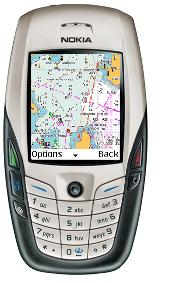
The Bonrix Track & Trace GPS System - a Unique and Innovative Location Based Services (LBS) is developed as web application software that provide clear view of persons or vehicles that are using by any organization or company for their work.
BTTGS has been developed as web-base and mobile phone software package that provide flexible view of there person or vehicles in map that on website.
In BTTGS we are providing extra facility like if person is not in connected area so it can't send data to sever in that case phone is stored data of location and update sever when persons or vehicles is in connected environment.
How this application works?
GPS devices detect your object and send that longitude and latitude to the phone via Bluetooth link. Phones will receive that data and send that data to sever via GPRS/TDEE/3G and using that data through internet connection you will able to see your object on website. Our website provides you the map display in which you can see you person or Vehicle position. Website provides you GUI which can help you to the run software.